 Last week we made considerable progress toward understanding Earth's global climate parameters, making it up to a comprehension of global convection cells and their climatic consequences like:
- The intertropical convergence zone (right)
- The global distribution of many of the world's major deserts at roughly 30 deg. N or S.
In many ways, though, the geographic distribution of land and oceans shapes regional and global climate. That is the topic of today.

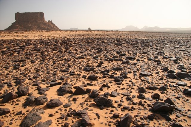
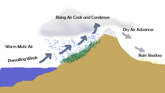
The global circulation model described above does not explain the distribution of all deserts. Some occur in places where they shouldn't be. We tend to think of the Pacific Northwest as being like Olympic National Park (right), but a short drive over the Cascades Mts. soon brings you to a broad arid region that is nowhere close to the 30 deg belt of global deserts. This is because of the rain shadow effect: When prevailing winds pass over high mountains, air is chilled and moisture precipitates out before reaching the lee side of the mountains. In effect, the mountains cast a "rain shadow" of aridity. Examples:
- Inland Pacific Northwest (in rain shadow of the Cascades)
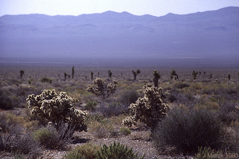
- Nevada and Utah (in rain shadow of the Sierras)
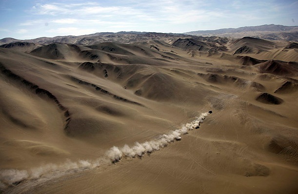
- Patagonia (in rain shadow of the Andes)
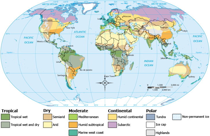
Climate zones: As the map of world climate zones above shows, rain shadow deserts are only one of many impacts of Earth surface conditions on climate. Really to grasp this, we must consider the oceans
Oceans: Earth's primary reservoir of water, easily dissolved ions, and heat, holding roughly 1000 times as much heat as the atmosphere. At the ocean's surface, this heat is exchanged between air and water. Moreover, colder water is denser.
Composition: Salinity is measured in parts per thousand (per mil). Varies between 33 per mil and 37 per mil. Solutes are generally ions such as:
- Sodium (Na+)
- Calcium (Ca2+)
- Chloride (Cl-)
- Carbonate (CO32-)
- Sulfate (SO42-)
Processes that influence salinity:
- Evaporation: removes water, increasing salinity.
- Precipitation: adds water, decreasing salinity.
- Runoff from land: adds water, decreasing salinity.
- Formation of glaciers: reduces runoff, increasing salinity.
- Freezing of sea ice: removes water, increasing salinity. (Note, sea ice is pure H2O and excludes dissolved ions.)
The net effect: Two factors determine sea water density:
- Temperature
- Salinity
Ocean water density distribution:
- Mixed layer: Warm and light water. Global average depth is 70 m. Up to 200 m depth at equator. May not exist at all in very cold polar waters.
- Deep zone: 500-900 m to bottom. Very cold water (2 deg. C)
- Thermocline: Zone of mixing and rapid temperature change. 100 m to 900 m.
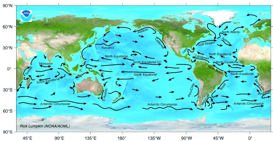 Ocean currents: Sea water doesn't just sit there. All global ocean circulation is ultimately driven by density contrasts between cold polar water and warmer waters of lower latitudes, but wind-powered surface currents act as catalysts. The interaction of surface currents driven by prevailing winds with the Coriolis effect generates currents that travel in great arcs along the western edges of oceans. Examples include:
- The Atlantic Gulf Stream
- The north Pacific Kuroshio
- The south Pacific East Australian current
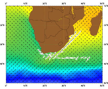
- The Indian Ocean Mozambique current
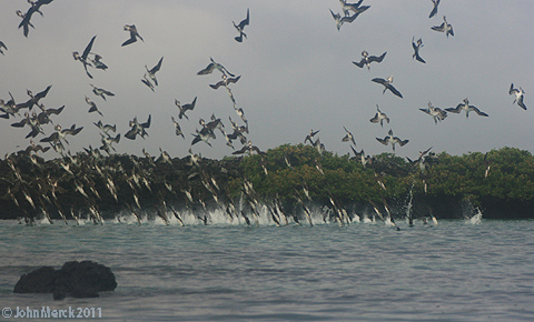 Upwelling: Something has to replace the water that is being moved by these currents. Typically, deep ocean waters well upward in regions where surface waters are being evacuated like the equatorial east Pacific. A significant source of nutrients for sea life. Indeed the comparison between the biologically productive waters near the Galápagos Islands (right) and the relatively sterile waters near Hawaii is striking. Of course any water upwelling from the deep oceans will be cold.
 Polar refrigeration: What replaces upwelling deep waters? In the modern Earth, surface waters plunge into the deep oceans mostly in two regions:
- The north Atlantic, source of North Atlantic Deep Water (NADW)
- The Antarctic, source of Antarctic Bottom Water (AABW)
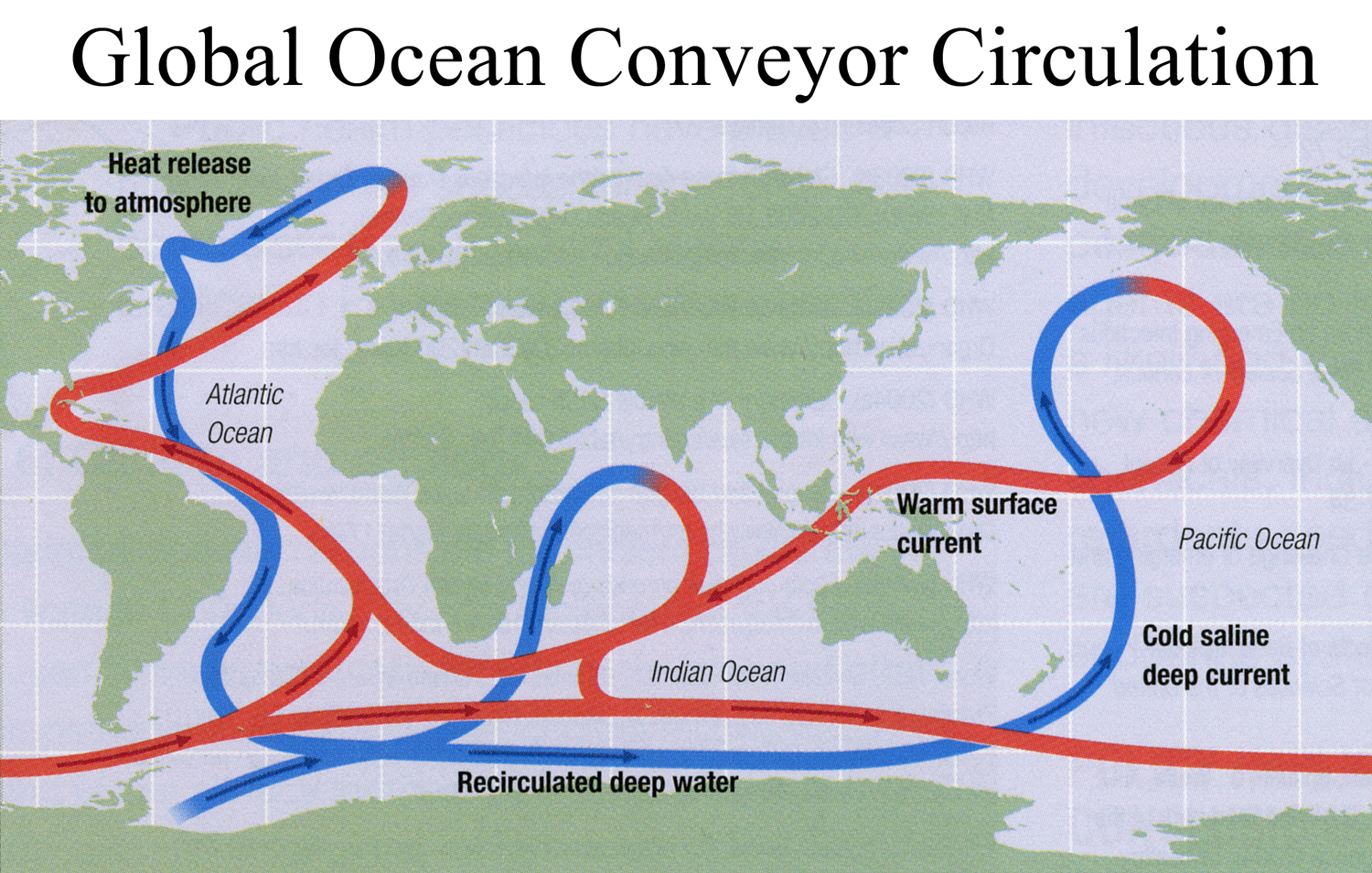 Thermohaline Circulation: In both regions, surface waters are significantly chilled and, through the formation of sea ice, become more saline. Why not the north Pacific? Through quirks of global oceanic and atmospheric circulation, the North Atlantic is more saline than the Pacific to begin with, making it more dense, and experiences higher rates of evaporation, making it yet more saline. Thus, for Atlantic and Pacific surface waters of the same temperature, Atlantic waters are more dense.
As chilled saline waters sink, they form deep ocean currents that flow roughly opposite those of the surface and eventually reach zones of upwelling. The result is called the Global ocean conveyor system or thermohaline circulation.
Note for later: These polar sources of deep ocean water are essentially the only places where ions and dissolved gasses in the mixed layer can get into the deep layer, limiting the rate at which excess atmospheric CO2 can be taken up by the oceans.
Idiosyncracies of atmospheric interactions with oceans and continents:
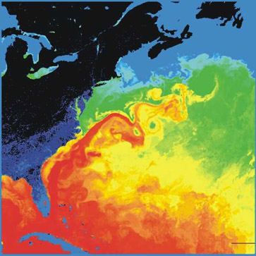 The Gulf Stream: Thermohaline circulation in the north Atlantic is dominated by the Gulf Stream, a surface current that brings warm waters of the Caribbean northeastward. Because of this and other attributes of Atlantic circulation, Western Europe is much warmer than other parts of the world at the same latitude. E.G. in London, it almost never snows, yet London is farther north than Halifax, Nova Scotia or Calgary, Alberta. (In fact, Washington DC is at roughly the same latitude as Lisbon, Portugal and Palermo, in Sicily.)
How would we know that such a process is starting?
 Monsoons: We said the intertropical convergence zone occurred at the equator where the influx of solar energy was greatest. On average, that is true, but during northern hemisphere summer, the greatest solar radiation is actually striking closer to the Tropic of Cancer; and in southern hemisphere summer, the Tropic of Capricorn. As a result, the ITCZ moves north and south with the seasons, moving slightly into the summer hemisphere. This has major effects when seasonal movement of the ITCZ causes it to move toward and away from major land masses like southern Eurasia, west Africa, the horn of Africa, and to lesser extents eastern South America and northern Australia. Thus:
- The intertropical convergence zone crosses the Indian Ocean south of the equator.
- The northern hemisphere Hadley cell pulls dry winds from the dry mainland across the effected land masses.
- The intertropical convergence zone moves north, crossing West Africa, the Horn of Africa, India and Southeast Asia.
- Those regions get moist winds from the Atlantic, Indian, and south Pacific oceans, pulled in by the southern hemisphere Hadley cell.
 El Niño Southern Oscillation (ENSO): Normal Pacific trade winds near equator (Hadley cell) blow to the west. Thus:
- Warm surface waters are transported westward and pile up in the west Pacific
- Cold nutrient-rich deep water water wells up in the east Pacific.
- Warmth of west Pacific surface water induces formation of low atmopsheric pressure and rainfall in the west Pacific. Note: This low pressure accelerates easterly trade winds which transport more warm water in a positive feedback loop. The result: The west Pacific is warm and its air humid, the east Pacific is cold and its air dry. The upwelling of cold waters in the east supports a substantial marine ecosystem.
The result:
- warm surface waters remain in East Pacific. The east Pacific gets significant rainfall. The west is relatively dry.
- Disaster for sea creatures who depend on nutrient upwelling and on animals that feed on them (sea-lions, fish, sea birds, etc.)
- Fat city for land plants and animals in East Pacific, who get lots of rain.
- Worldwide climatic ramifications. Indeed, Mathez states, "Next to seasons, ENSO is the most important recurrent change in climate."
- Note: El Niño years tend to be times of increased precipitation in the Middle Atlantic region.
North Atlantic Oscillation (NAO): A recurring (on the order of decades) climatic cycle of the North Atlantic, whose weather is dominated by a high-pressure cell near the Azores and a low pressure cell near Iceland:
|

|
 Remember this?
Snowmageddon 2010 was made possible by the combination of an El Niño year (moist) and the negative phase of the NAO (cold).

