

The ruins of an older world are visible in the present structure of our planet, and the strata which now compose our continents have
been once beneath the sea, and were formed out of the waste of pre-existing continents. The same forces are still destroying, by chemical
decomposition or mechanical violence, even the hardest rocks, and transporting these materials to the sea, where they are spread out, and form
strata analogous to those of more ancient date. -- The Theory of the Earth (1788) James Hutton
Etna presents us not merely with an image of the power of subterranean heat, but a record also of the vast period of time during which that power has been exerted. A majestic mountain has been produced by volcanic action, yet the time of which the volcanic forms the register, however vast, is found by the geologist to be of inconsiderable amount, even in the modem annals of the earth's history. In like manner, the Falls of Niagara teach us not merely to appreciate the power of moving water, but furnish us at the same time with data for estimating the enormous lapse of ages during which that force has operated. A deep and long ravine has been excavated, and the river has required ages to accomplish the task, yet the same region affords evidence that the sum of these ages is as nothing, and as the work of yesterday, when compared to the antecedent periods, of which there are monuments in the same district. -- Travels in North America, Vol. 1 (1845) Sir Charles Lyell
BIG QUESTION: How do rocks form? How do they record past environments?
Structure of the Earth
Different researchers might recognize various subdivisions of the spheres. Here is a list, running from the most
interior (deepest and densest) outwards:
The deep interior of the Earth interacts with the parts in which climate happens and we live, but generally only very slowly. Our knowledge of the interior comes almost exclusively from various forms of remote sensing: despite movies the contrary, we do not have the means to drill deep into the mantle or to the core.
The innermost part of the earth is the core, comprised largely of the metals iron and nickel. The inner core is solid, despite having temperatures over 5700 K: with pressures of 330-360 gigapascals the metals are compressed into a solid crystalline structure. The radius of the inner core is 1220 km. The inner core is surrounded by the 2260 km thick outer core, which is liquid. Motions of this vast inner sea of molten metal generates the magnetic field of our planet. The core is hot because of heat left over from the initial formation of the planet, but also (far more importantly) from radioactive decay of various isotopes and the heat of crystallization of the growing inner core.
Surrounding the core is the 2890 km thick rocky mantle. The mantle represents 85% of the Earth's volume. It is basically solid, but because it is hot and under pressure it can flow like tremendously dense silly putty. The mantle rock is very dense: much denser than the typical rocks found on the continent or the ocean floor.
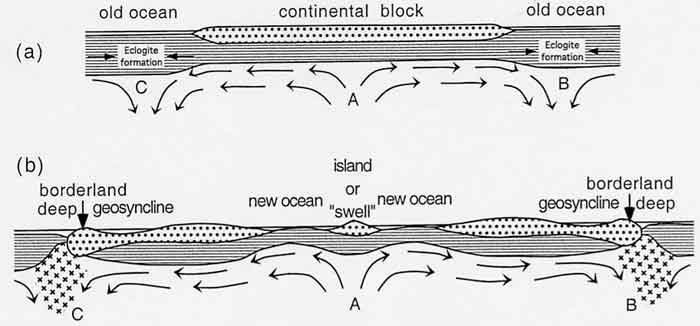
Heat from the core-mantle boundary is dissipated by the formation of vast convection cells in the
mantle:
This motion (moving at rates comparable to finger nail growth: a few cm per year) drives the action of shallower
geology. The mantle plays a role in the long term carbon cycle, but is otherwise mostly isolated from
climate actions.
Technically speaking, the lithosphere is a dynamic subdivision of the Earth, whereas the core and
mantle are compositional subdivisions. The mantle is covered by the brittle rocky part of the Earth: the crust
(which ranges from about 5 km to 50 km deep). Functionally, however, the outermost mantle shell and the crust move
as a single unit, collectively the lithosphere. The lithosphere is divided into various plates, which
move relative to each other as a result of the mantle convection cells below. Interaction between plates results
in nearly all of geological phenomena:
Such action results in the widening of oceans; the motion of continents; the loss (subduction of older
oceanic crust back into the mantle; the driving of volcanoes and earthquakes; the uplift of new mountains;
and more.
The lithosphere rides along a mobile asthenosphere, a portion of the mantle where temperature-pressure conditions support the presence of many molten droplets within the rock.
Compositionally, the crust is phenomenally diverse. All sorts of rocks are formed and deposited here. The lithosphere is also a region of various types of activity, continuous or episodic, small-scale to catastrophic. Some of the major ones to consider are:
Lithospheric processes thus both add and subtract material from surficial Earth systems, and these might be as slow as the erosion of a mountain range or as rapid as the eruption of a volcano.
Some data difficult to explain if the continents did not move:
It was discovered in late 19th Century that the sea floor is flat, everywhere dense volcanic rock: very different from continents with mixed rock types and much lower average density. Thus, the ocean floor does NOT represent simply submerged versions of today's continents. The submergence/emergence model of past geography was clearly rejected. Additionally, it was discovered that when mapped out, earthquakes and volcanoes tend to follow particular tracks along the margins of some continents, in the middle of oceans, and other additional patterns that called for some explanatory theory.
Continental Drift: Theory proposed by Alfred Wegener, German geophysicist and glaciologist, in 1915. His model: the light continental masses move over dense layer of oceanic crust (by analogy to motion of light glacial ice moving over bedrock below.) Volcanoes, mountain building, earthquakes caused by crumpling of continental masses as they move along. In the distant past the continents were united together, but subsequently some force broke them apart and is moving them ever since.
Resistance to continental drift was strong in the US, Canada, and the UK (although more widely accepted by Southern Hemisphere geologists.) In part, northern resistance because Wegener failed to propose causal mechanism that could be well-verified (not that their own stabilist model had a verified causal mechanism, either!) But there were ad hominem components to the rejection, too: in part, post-war Germanophobia, and in part, cross-disciplinary "snobbery". At a 1926 Meeting of American Association of Petroleum Geologists, the majority of the talks were strongly against Continental Drift. From this point on, continental drift became a fringe subject among northern hemisphere geologists
Sea-Floor Spreading: In the 1940s and 1950s some geologists (notably Arthur Holmes and Harry Hess) had proposed a mechanism to move continents: the coninents did not move OVER the oceanic crust, but carried along with it as the sea-floor itself was recycled. In post-WWII era, additional discoveries concerning depth of earthquakes, age of oceanic crust confirmed sea-floor spreading.
Plate Tectonics: models of continental drift and sea-floor spreading were combined by John Tuzo Wilson and colleagues to form plate tectonics.
Major plate boundaries, from online USGS pamphlet "This Dynamic Earth".
Plate velocities predicted by theory confirmed by GPS studies in 1990s
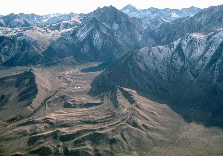
Heat from Earth's core moves plates, forming mountain ranges at subduction and collision boundaries. Weather erodes uplifting mountains, wind and water and ice transports sediment to depositional environments. Over time, material becomes buried.
Plates wander over Earth's surface, so continents move from tropics to poles or back. Also, action of mid-ocean ridges causes sea levels to rise up (flooding continents) or lower (draining continents). (Current situation is very low sea level).
Big change from the 1960s-1970s model: now recognize there are LOTS of little plates (terranes) rather than just a few big plates.
Here is a brief animation of estimates of the position of the continental masses over the last half-billion years or so (thus, the time scale of the course):
Rocks (naturally occurring cohesive solids comprised of one or more minerals or mineraloids) are generated in one of three primary manners (which form the basis of rock classification). Or, to put it another way, every rock is a record of the environment in which it formed:
It is important to consider, however, that not all environments are environments of deposition. Many locations will be environments of erosion: these places are sources of sediment, but because material is being lost from there rather than accumulating there, they will not wind up in the geologic record. A particular location can shift between deposition and erosion ("D-world" vs. "E-world") as local environmental conditions change.
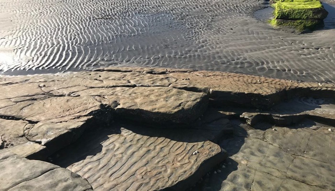
Here are some aspects of depositional environment to consider:
By observing modern environments and their sediments and sedimentary structures, we can use the clues mentioned above (as well as other aspects) to reconstruct the paleoenvironment. Major environments of deposition represented in the geologic record include:
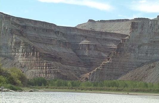
NOTE: Present day sea level is much lower than most of Earth History; also, as new mountains are born, once shallow deposits are uplifted. Consequently, even in the middle of continents, it is common to find sedimentary rocks deposited underwater. In fact, rocks deposited in marine environments are extremely common, even in the interiormost parts of continents.
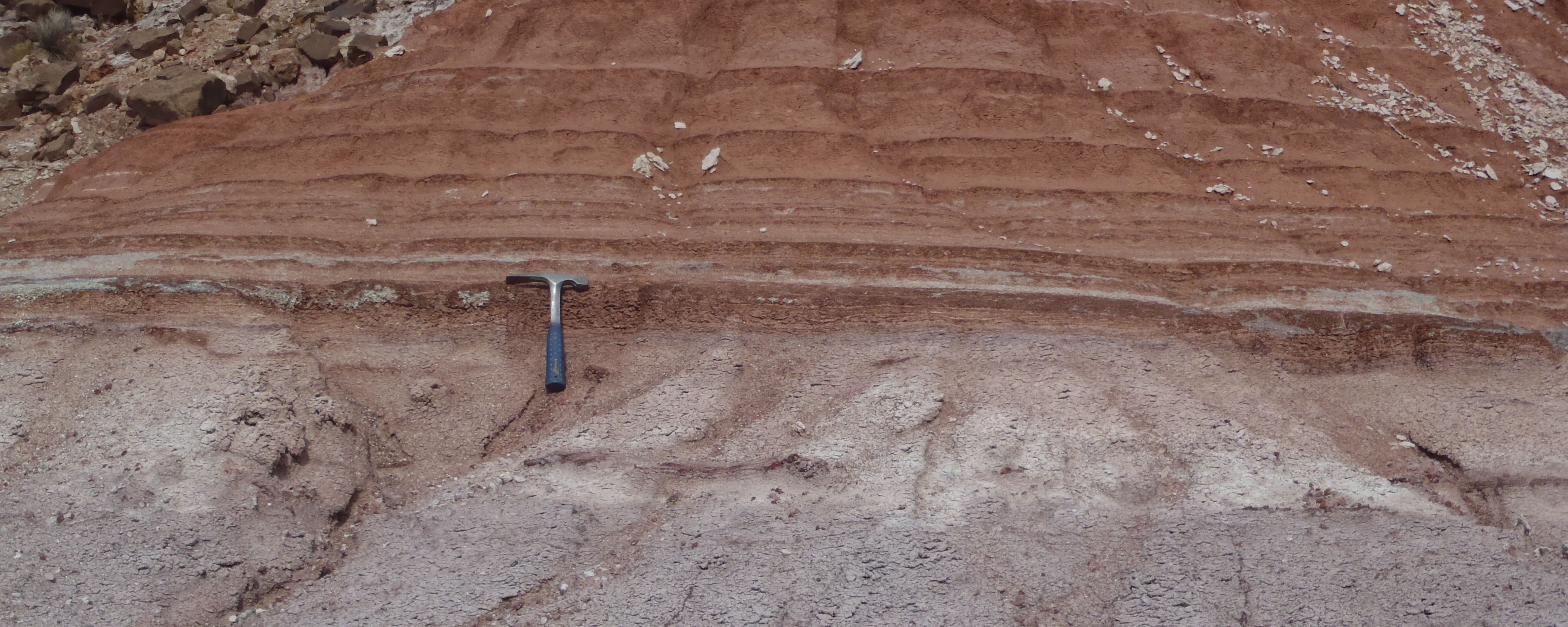
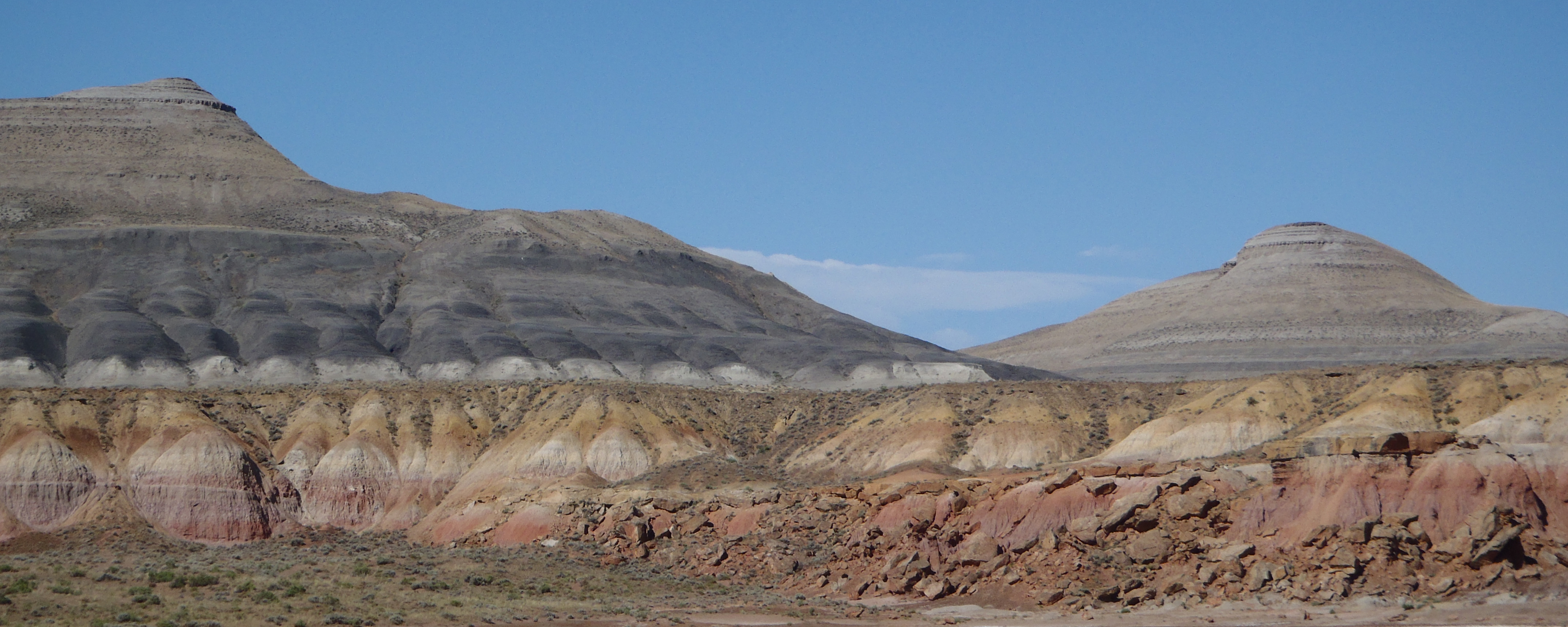
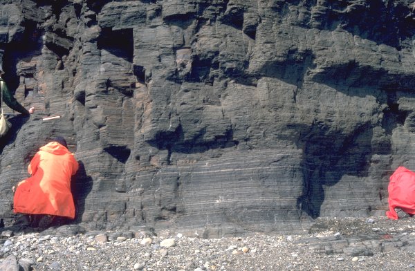
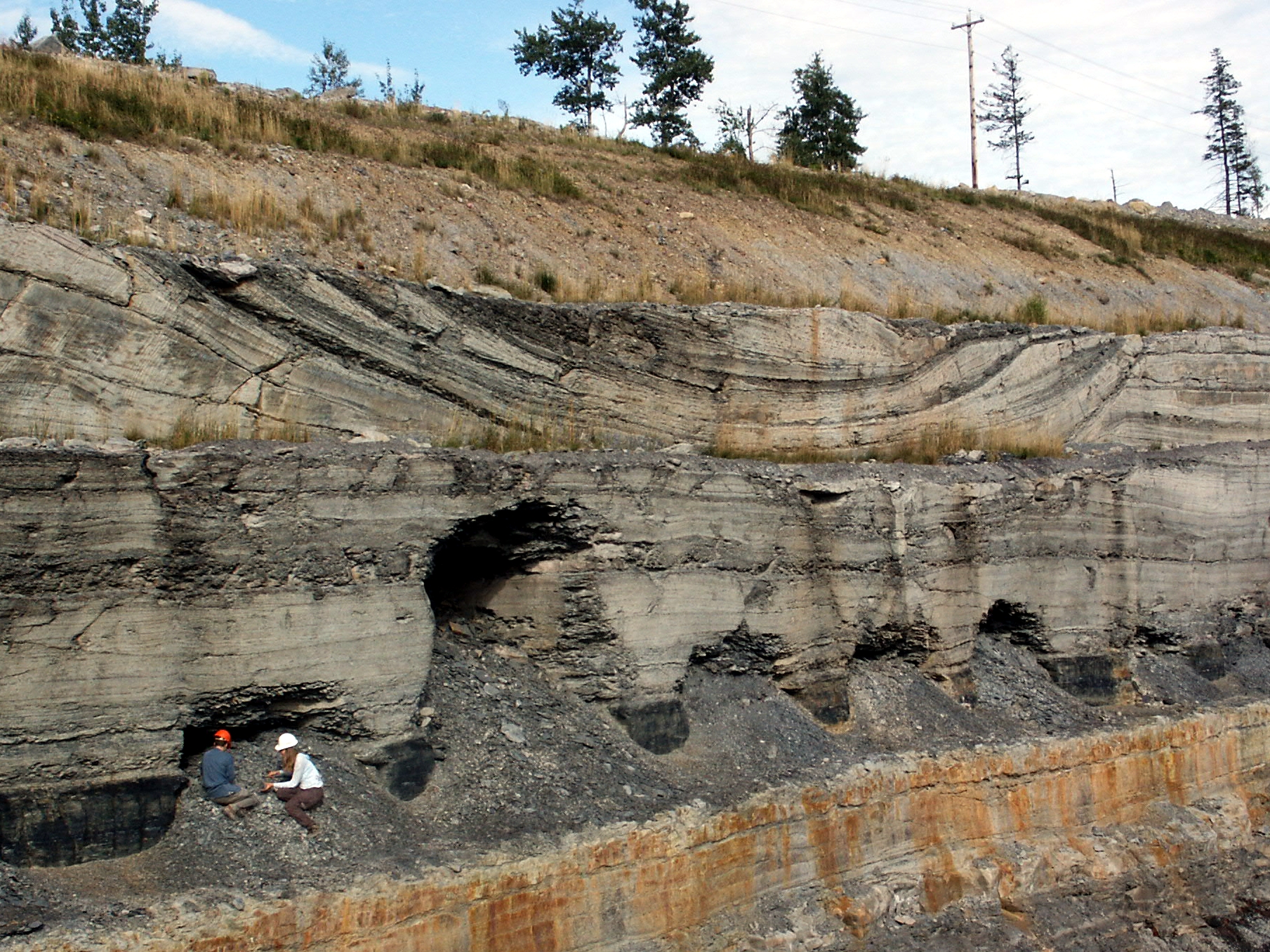
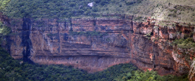
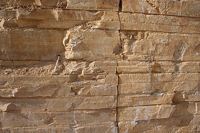
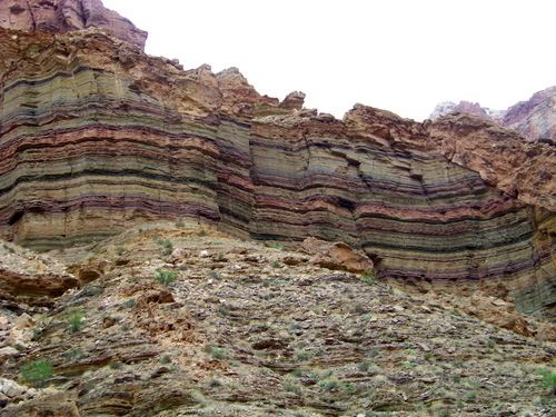
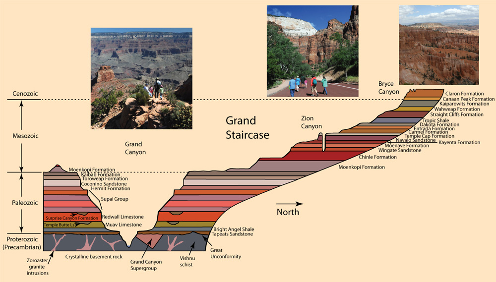
Whatever the environment of deposition, the sediment is laid down in layers (strata). Since every rock is a record of the environment in which it formed, the strata will be of the same general sort while the environment remains the same, and change to a different sort as the environment changes. Packages of similar strata formed over a region are called formations: at any given spot, if we see a section through the bedrock, we can see the transition from one formation to another, representing a transition from one environment to another.
These factors -- alone or in combination -- can bind the sediment together, transforming it into sedimentary rock.
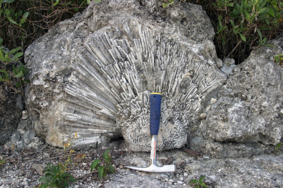
Lithification is an example of diagenesis: post-depositional alteration of sediment. We will see diagenetic effects in another context shortly, in fossilization.
Plate tectonics ultimately drives the Rock Cycle: